
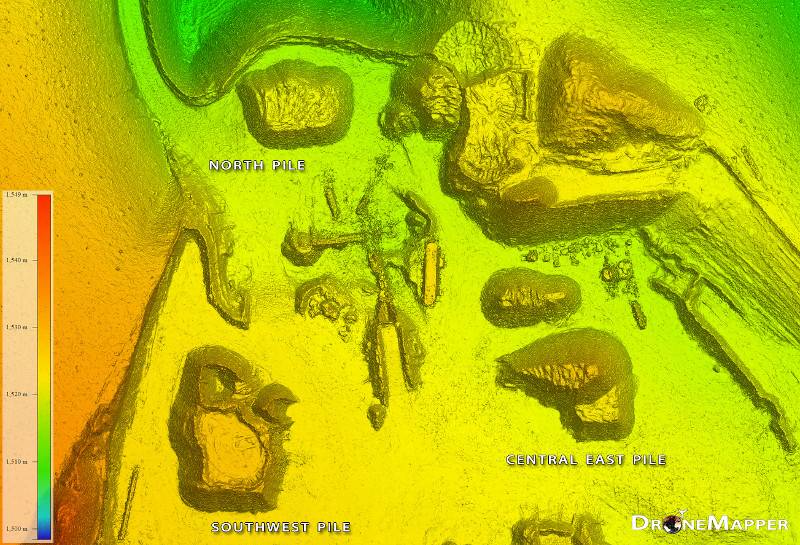
Inventory Tracking
Regular inventory and stockpile volume calculations increases efficiency and productivity.


Regular inventory and stockpile volume calculations increases efficiency and productivity.
Mine and quarry operations can achieve great improvements in efficiency by performing regular site surveys, collecting data for their whole operation in hours rather than days.Mine and quarry operations can achieve great improvements in efficiency by performing regular site surveys, collecting data for their whole operation in hours rather than days.
Highly accurate drone data can help with site planning, optimising the design of haul riads, loading floors, stockpile locations and more. In addition drone data can be used to assess road, floor and slope conditions to ensure compliance and operational safety.
Regular drone flights can collect data to give highly accurate volumetric data.