Home
UAV Services
Agriculture
Engineering & Construction
Mining, Quarries & Aggregates
Survey & Mapping
Our Tools
Case Studies
About us
Menu
Home
UAV Services
Agriculture
Engineering & Construction
Mining, Quarries & Aggregates
Survey & Mapping
Our Tools
Case Studies
About us
Contact Us
Case Studies
Whether it is city wide mapping or nation wide asset inspection we have you covered.
Contact Us
Orecorp Limited
Full SML topographic survey, for land use planning and compensation payments.
BENEFIT: 60 sq/km surveyed in 2 days.
LOCATION: Tanzania, Nyangaza Mwanza.
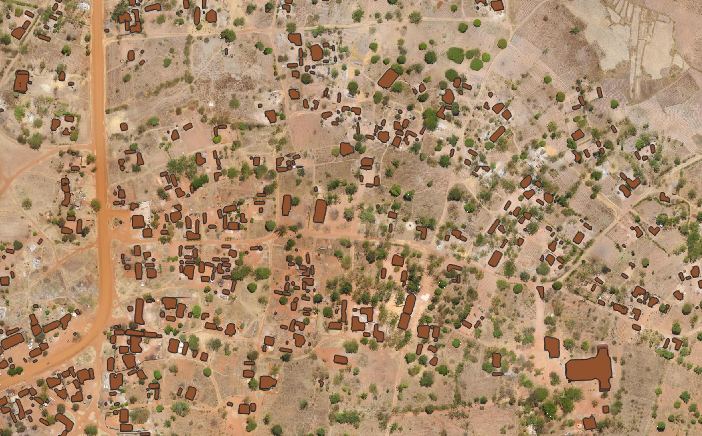
Example of AI building footprint detection.
AI For Automatic Building Footprint Detection
Tower Asset Inventory
Simultaneous deployment of 6 teams across Tanzania.
Drone scan of over 800 cellular towers
Production of digital twin of each tower.
AI identificaiton and classificaiton of Tower assets.